Sunday, July 27, 2008
Wednesday, June 11, 2008
Sunday, March 30, 2008
Tuesday, January 02, 2007
German Ocean
 The North Sea (historically also known as the German Ocean) is a part of the Atlantic Ocean, located between Norway and Denmark in the east, Scotland and England in the west, and Germany, the Netherlands, Belgium and France in the south. An offshoot of the North Sea is the Skagerrak, between Denmark, Norway, and Sweden, which connects to the Baltic Sea through the Kattegat, Öresund, the Great Belt and the Little Belt. In the south, the North Sea connects with the rest of the Atlantic through the Strait of Dover into the English Channel and in the north through the Norwegian Sea.
Picture © 2007 onwards by Dr Himanshu Tyagi. All the photographs in this blog are copyright protected and can not be reproduced or stored in any medium without the written permission from Dr Himanshu Tyagi.
Chorus
 Gulls — the larger species in particular — are resourceful and highly-intelligent birds, demonstrating complex methods of communication and a highly-developed social structure. Certain species (e.g. the Herring Gull) have exhibited tool use behaviour. Many species of gull have learned to co-exist successfully with man and have thrived in human habitats. Others rely on kleptoparasitism to get their food.
Picture © 2007 onwards by Dr Himanshu Tyagi. All the photographs in this blog are copyright protected and can not be reproduced or stored in any medium without the written permission from Dr Himanshu Tyagi.
Sleeping Dragon
Fun
Felixstowe
Sea and Sand
Footprint
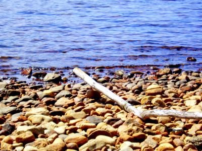
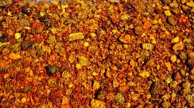
Pebbles
 A pebble is a clast of rock with a grain size of 4 to 64 millimeters based on the Krumbein phi scale of sedimentology.
Picture © 2007 onwards by Dr Himanshu Tyagi. All the photographs in this blog are copyright protected and can not be reproduced or stored in any medium without the written permission from Dr Himanshu Tyagi.
Sunday, October 15, 2006
Alone
Monday, October 02, 2006
Pembroke College
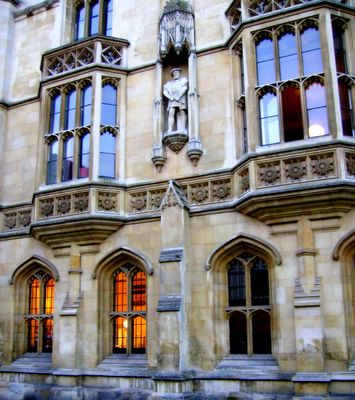
On Christmas Eve 1347, Edward III granted Marie de St Pol, widow of the Earl of Pembroke, the licence for the foundation of a new educational establishment in the young university at Cambridge. The Hall of Marie Valence, as it was originally known, was thus founded to house a body of students and fellows. The statutes were notable in that they both gave preference to students born in France who had already studied elsewhere in England, and that they required students to report fellow students if they indulged in excessive drinking or visited disreputable houses. The college was later renamed Pembroke House, and finally became Pembroke College in 1856.
Picture © 2006 onwards by Dr Himanshu Tyagi. All the photographs in this blog are copyright protected and can not be reproduced or stored in any medium without the written permission from Dr Himanshu Tyagi.
Sunday, September 24, 2006
Buckingham Palace
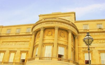
Buckingham Palace is the official London residence of the British monarch. The Palace is a setting for state occasions and royal entertaining, a base for all officially visiting Heads of State, and a major tourist attraction. It has been a rallying point for British people at times of national rejoicing, crisis or grief. "Buckingham Palace" or simply "The Palace" commonly refers to the source of Press statements issued by the offices of the Royal Household.
Picture © 2006 onwards by Dr Himanshu Tyagi. All the photographs in this blog are copyright protected and can not be reproduced or stored in any medium without the written permission from Dr Himanshu Tyagi.
Sunday, September 03, 2006
Hardy's Monument
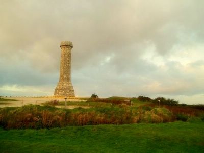
Hardy's Monument is a 72 foot high monument situated on a high chalk hill overlooking the English Channel in the Blackdown area near Portesham in Dorset, England.
Picture © 2006 onwards by Dr Himanshu Tyagi. All the photographs in this blog are copyright protected and can not be reproduced or stored in any medium without the written permission from Dr Himanshu Tyagi.
Wednesday, July 26, 2006
Leafless
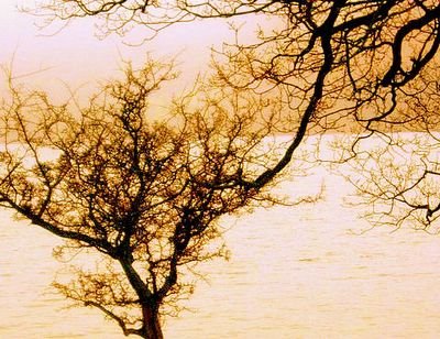
Many deciduous plants flower during the period when they are leafless, as this increases the effectiveness of pollination. The absence of leaves improves wind transmission of pollen in the case of wind-pollinated plants, and increases the visibility of the flowers to insects in insect-pollinated plants. This strategy is not without risks, as the flowers can be damaged by frost, or in dry season areas, result in water stress on the plant. Nevertheless, by losing leaves in the cold winter days, plants can reduce water loss since most of the water would appear as ice.
Picture © 2006 onwards by Dr Himanshu Tyagi. All the photographs in this blog are copyright protected and can not be reproduced or stored in any medium without the written permission from Dr Himanshu Tyagi.
Thursday, July 20, 2006
Lake Hogwarts
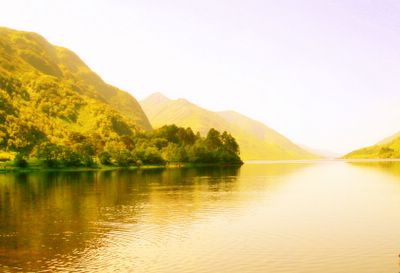
Loch Shiel is used as Lake Hogwarts in the Harry Potter movies, with Hogwarts itself placed next to the Loch through computer-generated imagery.
Picture © 2006 onwards by Dr Himanshu Tyagi. All the photographs in this blog are copyright protected and can not be reproduced or stored in any medium without the written permission from Dr Himanshu Tyagi.
The Highlands
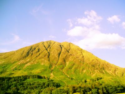
The Highlands consist of an old dissected plateau, or block, of ancient crystalline rocks with incised valleys and lochs carved by the action of mountain streams and by ice, the resulting topography being a wide area of irregularly distributed mountains whose summits have nearly the same height above sea-level, but whose bases depend upon the amount of denudation to which the plateau has been subjected in various places.
Picture © 2006 onwards by Dr Himanshu Tyagi. All the photographs in this blog are copyright protected and can not be reproduced or stored in any medium without the written permission from Dr Himanshu Tyagi.
Wednesday, July 19, 2006
Cobbler

Arrochar is a village located near the head of Loch Long in Argyll and Bute, Scotland. It is overlooked by a group of mountains called the Arrochar Alps, and in particular by the distinctive rocky summit of The Cobbler. It enjoys good communications as it is at the junction of the A83 and A814 roads and is served by Arrochar and Tarbet railway station. In addition the A82 road runs through Tarbet two miles to the east.
Picture © 2006 onwards by Dr Himanshu Tyagi. All the photographs in this blog are copyright protected and can not be reproduced or stored in any medium without the written permission from Dr Himanshu Tyagi.
Arrochar Alps

The Arrochar Alps are a group of mountains located around the head of Loch Long, near the village of Arrochar in Argyll, Scotland. The mountains are especially popular with hillwalkers, due to their proximity and accessibility from Glasgow.
Picture © 2006 onwards by Dr Himanshu Tyagi. All the photographs in this blog are copyright protected and can not be reproduced or stored in any medium without the written permission from Dr Himanshu Tyagi.
Mallard
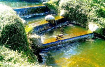
The female Mallard is light brown, with plumage much like most female dabbling ducks. It can be distinguished from other ducks, by the distinctive speculum. In non-breeding (eclipse) plumage, the drake looks more like the female.
Picture © 2006 onwards by Dr Himanshu Tyagi. All the photographs in this blog are copyright protected and can not be reproduced or stored in any medium without the written permission from Dr Himanshu Tyagi.
Loch Linnhe
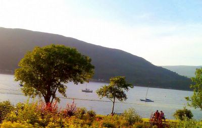
Loch Linnhe is a sea loch on the west coast of Scotland. Loch Linnhe extends 15 kilometers and is an average of 2 kilometers wide. It opens onto the Firth of Lorne at its southwestern end by Loch Leven. The town of Fort William lies at the northeast end of the loch at the mouth of the River Lochy. Loch Eil feeds into Loch Linnhe at the latter's northernmost point. During the summer months Loch Linnhe is aligned with the setting sun, making it a popular location for photographers.
Picture © 2006 onwards by Dr Himanshu Tyagi. All the photographs in this blog are copyright protected and can not be reproduced or stored in any medium without the written permission from Dr Himanshu Tyagi.
Tuesday, July 18, 2006
Golden Z
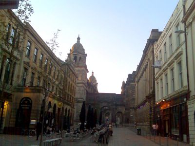
Glasgow City Centre is based on a grid system of streets on the north bank of the River Clyde. The heart of the city is George Square, site of many of Glasgow's public statues and the Glasgow City Chambers, headquarters of Glasgow City Council. To the south and west are the shopping precincts of Argyle, Sauchiehall and Buchanan Streets. The main shopping malls are Buchanan Galleries and the St Enoch Centre, as well as the more specialised, designer malls; Princes Square and the Italian Centre. The London-based department stores, Selfridges and Harvey Nichols are planning to open in the city, further strengthening Glasgow's already impressive retail portfolio, which forms the UK's largest and most economically important commerce and retail sector after London's West End. The layout of the shopping district of Buchanan Street, Sauchiehall Street and Argyle Street has been termed the "Golden Z".
Picture © 2006 onwards by Dr Himanshu Tyagi. All the photographs in this blog are copyright protected and can not be reproduced or stored in any medium without the written permission from Dr Himanshu Tyagi.
Glasgow
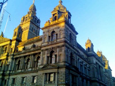
Unlike Edinburgh, very little of medieval Glasgow remains, the two main landmarks from this period being the 14th century Provand's Lordship and Glasgow Cathedral. The vast majority of the city as seen today dates from the 19th century. As a result, Glasgow has an impressive heritage of Victorian architecture. The buildings reflect the wealth and self confidence of the residents of the "Second City of the Empire". Glasgow generated immense wealth from trade and the industries that developed from the Industrial Revolution. The shipyards, marine engineering, steel making, and heavy industry all contributed to the growth of the city. At one time the expression "Clydebuilt" was synonymous with quality and engineering excellence. The Templeton's Carpet Factory on Glasgow Green was designed to resemble the Doge's Palace in Venice. The allusions to another great trading city, seem appropriate.
Picture © 2006 onwards by Dr Himanshu Tyagi. All the photographs in this blog are copyright protected and can not be reproduced or stored in any medium without the written permission from Dr Himanshu Tyagi.
Glenfinnan Monument
Annandale Water

It is situated 40 miles north of Carlisle in the beautiful Scottish countryside of Dumfriesshire.
Picture © 2006 onwards by Dr Himanshu Tyagi. All the photographs in this blog are copyright protected and can not be reproduced or stored in any medium without the written permission from Dr Himanshu Tyagi.
Sunday, July 16, 2006
Argyll

Argyll, archaically Argyle, is a region of western Scotland corresponding with ancient Dal Riata, and can be used to mean the entire western seaboard between the Mull of Kintyre and Cape Wrath. The early thirteenth century author of De Situ Albanie explains that "the name Arregathel means margin of the Scots or Irish, because all Scots and Irish are generally called Gattheli [=Gaels], from their ancient warleader known as Gaithelglas." Argyll was a medieval Bishopric too, with its cathedral at Lismore, as well as an early modern Earldom and Duchy, the Duchy of Argyll.
Picture © 2006 onwards by Dr Himanshu Tyagi. All the photographs in this blog are copyright protected and can not be reproduced or stored in any medium without the written permission from Dr Himanshu Tyagi.
Loch Leven
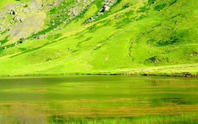
Loch Leven extends 14 kilometers, varying in width between 200 and 1800 meters. It opens onto Ballachulish Bay, part of Loch Linnhe at its western end. There are seven small islands, some rocky and covered with heather and some just smooth green grass, near the western end of the loch.
Picture © 2006 onwards by Dr Himanshu Tyagi. All the photographs in this blog are copyright protected and can not be reproduced or stored in any medium without the written permission from Dr Himanshu Tyagi.
Bonnie Prince Charlie
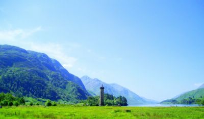
In 1815, Alexander Macdonald of Glenaladale built a memorial tower at Glenfinnan commemorating the raising of the standard. The tower was designed by the Scottish architect James Gillespie Graham. Hundreds of Jacobite enthusiasts gather there each year on the 19th of August. The National Trust for Scotland's Visitor Centre at Glenfinnan provides tickets, information and exhibitions, and a shop, cafe, and toilets. The tower has also become a monument to Alexander Macdonald, who died before its completion.
Picture © 2006 onwards by Dr Himanshu Tyagi. All the photographs in this blog are copyright protected and can not be reproduced or stored in any medium without the written permission from Dr Himanshu Tyagi.
Glenfinnan
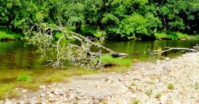
Glenfinnan is a village in Lochaber, Highland, Scotland. It is located at the northern end of Loch Shiel, at the foot of Glen Finnan.
Picture © 2006 onwards by Dr Himanshu Tyagi. All the photographs in this blog are copyright protected and can not be reproduced or stored in any medium without the written permission from Dr Himanshu Tyagi.
Aonach Eagach
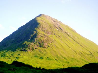
The Aonach Eagach is a rocky ridge lying to the north of Glen Coe in the Scottish Highlands, boasting two Munro summits. The name means notched ridge in Gaelic. It is sometimes known by the somewhat tongue-in-cheek name "Aggy Ridge".
Picture © 2006 onwards by Dr Himanshu Tyagi. All the photographs in this blog are copyright protected and can not be reproduced or stored in any medium without the written permission from Dr Himanshu Tyagi.
A82
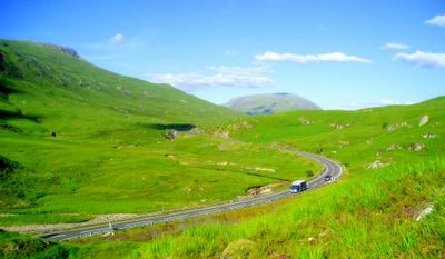
The A82 is the major road to the western Scottish Highlands, running from Glasgow to Inverness.
The A82 begins in the Charing Cross area of Central Glasgow, before threading through the city's fashionable West End. Glasgow's famous "Boulevard" (officially known as Great Western Road), is in fact the urban section of the A82. As it threads through the north west of the city, it passes through Kelvinside, Anniesland, Clydebank and Dumbarton before turning north to head up the western shore of Loch Lomond. At Tarbet it splits, leaving the A83 to continue to the west. (The A83 passes through the similarly named Tarbert before eventually arriving at Campbeltown, its ultimate destination).
From Tarbet, the A82 then leads through Crianlarich and Tyndrum, where it splits again.
Picture © 2006 onwards by Dr Himanshu Tyagi. All the photographs in this blog are copyright protected and can not be reproduced or stored in any medium without the written permission from Dr Himanshu Tyagi.
Buachaille Etive Mòr
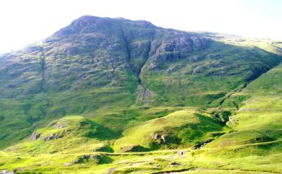
The Buachaille Etive Mòr is a mountain at the south eastern end of Glen Coe, in the Highlands of Scotland. The name Buachaille Etive Mòr is from the Gaelic meaning "Great Shepherd of Etive". It is often simply called "The Beuckle" by the climbing fraternity.
Buachaille Etive Mòr has a steep craggy north-eastern face, and from the A82 road near the Kingshouse it appears as an almost perfect rocky pyramid. For this reason it is one of the most photographed mountains in Scotland. In fact the north-eastern summit, Stob Dearg, is simply the start of a ridge some 5 km in length, at the south-western end of which lies Stob na Bròige. This peak which was promoted to Munro status by the SMC in 1997. Between the two Munros lie several additional summits, the most notable of which is Stob na Doire (1011 m).
Picture © 2006 onwards by Dr Himanshu Tyagi. All the photographs in this blog are copyright protected and can not be reproduced or stored in any medium without the written permission from Dr Himanshu Tyagi.
Loch Lomond

This freshwater loch is approximately 37 kilometres long, and up to 8 kilometres wide, with an average depth of about 37 metres, and a maximum depth of about 190 metres. It has a surface area of approximately 71 square kilometres, and a volume of about 2.6 km3. Its surface area is the largest of the lochs, and is second biggest after Loch Ness in terms of water volume in Great Britain, although it is not the largest in the British Isles - this distinction belongs to Lough Neagh in Northern Ireland.
Picture © 2006 onwards by Dr Himanshu Tyagi. All the photographs in this blog are copyright protected and can not be reproduced or stored in any medium without the written permission from Dr Himanshu Tyagi.
Loch Long

Loch Long is a body of water in Argyll and Bute, Scotland. The sea loch extends from the Firth of Clyde at its southwestern end. It measures approximately 20 miles in length, with a width of between one and two miles.
Picture © 2006 onwards by Dr Himanshu Tyagi. All the photographs in this blog are copyright protected and can not be reproduced or stored in any medium without the written permission from Dr Himanshu Tyagi.
Highlands
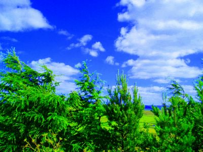
The Scottish Highlands are the mountainous regions of Scotland north and west of the Highland Boundary Fault. It is popularly described as one of the most scenic regions of Europe.
Picture © 2006 onwards by Dr Himanshu Tyagi. All the photographs in this blog are copyright protected and can not be reproduced or stored in any medium without the written permission from Dr Himanshu Tyagi.
End
Glenfinnan Viaduct
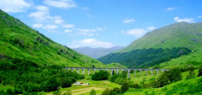
Glenfinnan Viaduct is a viaduct on the West Highland Railway in Glenfinnan, Lochaber, Highland, Scotland. It was built between 1897 and 1901. Located in the West Highlands of Scotland, it forms an integral part of the West Highland Line. The 21-arch viaduct was one of the largest engineering undertakings using concrete when it was built by Robert McAlpine (who earned the nickname "Concrete Bob").
The West Highland Line connects Fort William and Mallaig, and was a crucial vein for the local fishing industry and the highlands economy in general, which suffered enormously after the Highland Clearances of the late 1800s. Nowadays, the trains that cross are usually diesel multiple units, but in the summer, the heritage Jacobite steam train operates. It is a popular tourist event in the area, and the viaduct is one of the major drawcards of the line.
The Glenfinnan Viaduct has been used as a location in several films and television series, including Charlotte Gray, Monarch of the Glen, and most famously Harry Potter and the Chamber of Secrets in which the Hogwarts Express is seen crossing the viaduct. It additionally appeared in two subsequent Harry Potter films; The Prisoner of Azkaban and The Goblet of Fire.
Picture © 2006 onwards by Dr Himanshu Tyagi. All the photographs in this blog are copyright protected and can not be reproduced or stored in any medium without the written permission from Dr Himanshu Tyagi.
Pebbles
Subscribe to:
Comments (Atom)


