Monday, October 03, 2005
White Horse
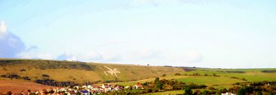
This white horse figure is one of the many found over the hills in Dorset, England. This figure has been carved on chalk stone and is the only white horse figure in England with a rider.
Picture © 2005 onwards by Dr Himanshu Tyagi. All the photographs in this blog are copyright protected and can not be reproduced or stored in any medium without the written permission from Dr Himanshu Tyagi.
Dusk
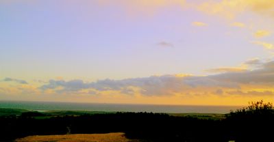
Dusk or civil dusk is the time at which the sun is 6 degrees below the horizon in the evening. At this time objects are distinguishable but there is no longer enough light to perform any outdoor activities. Nautical dusk is the time at which the sun is 12 degrees below the horizon in the evening. At this time, objects are no longer distinguishable, and the horizon is no longer visible to the naked eye. Astronomical dusk is the time at which the sun is 18 degrees below the horizon in the evening. At this time the sun no longer illuminates the sky. Dusk should not be confused with sunset, which is the moment when the trailing edge of the Sun itself sinks below the horizon.
Picture © 2005 onwards by Dr Himanshu Tyagi. All the photographs in this blog are copyright protected and can not be reproduced or stored in any medium without the written permission from Dr Himanshu Tyagi.
Portesham
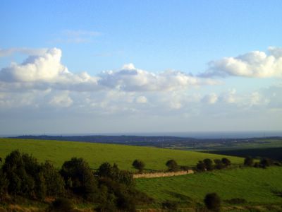
Portesham is a village in the English county of Dorset, situated close to the south coast, between the towns of Weymouth and Dorchester. The village has a population of 708 (2001). The village of Abbotsbury is nearby, as is Hardy's Monument, erected in honour of Captain Thomas Hardy, one of Lord Nelson's commanders at the Battle of Trafalgar. Portesham is also in walking distance of the Jurassic Coast. This view is of the surronding area around Portesham.
Picture © 2005 onwards by Dr Himanshu Tyagi. All the photographs in this blog are copyright protected and can not be reproduced or stored in any medium without the written permission from Dr Himanshu Tyagi.
Hardy's Monument
Hardy's Monument is a 72foot high monument erected in memorial of Captain Thomas Hardy, a commander at the Battle of Trafalgar. The monument is situated on a high chalk hill overlooking the English Channel in the Blackdown area near Portesham in Dorset, England.
Picture © 2005 onwards by Dr Himanshu Tyagi. All the photographs in this blog are copyright protected and can not be reproduced or stored in any medium without the written permission from Dr Himanshu Tyagi.
Chesil Beach
Chesil Beach (sometimes called Chesil Bank) is a 18 mile (29km) long, 200 metre wide and 18 metre high shingle tombolo in Dorset, southern England. The beach is part of the Jurassic Coast World Heritage Site. This tombolo connects the Isle of Portland, a limestone island in the English channel to Abbotsbury, though it continues westwards to West Bay near Bridport, and it is the largest tombolo in England. The beach is steep showing a clear storm beach. Pebbles on the beach are graded, getting coarser nearer Portland, and fishermen familiar with the beach claim to be able to tell their location from pebble size alone. The pebbles are mainly flint and chert from the Cretaceous rocks which make up this stretch of the Heritage Coast. The origin of the beach has been argued over for some time, originally believed to be from the Budleigh Salterton pebble beds to the west and later from Portland to the south east. The differences between the pebbles on the beach and nearby sources is now put down to the Flandrian isotactic sea level rise so the feature could also be considered a barrier beach or bar that happens to connect the mainland to an island rather than a 'true' tombolo that is created due to the effects of the island on waves (through refraction) and so sediment transport. This usually produces a beach perpendicular to the mainland rather than parallel to it. The beach provides shelter from the prevailing winds and waves for the towns of Weymouth and Fortuneswell, which otherwise would probably not exist. At the Isle of Portland end of the beach, the beach curves round sharply to form Chesil Cove. This part of the beach protects the low lying village of Chiswell from flooding.
Picture © 2005 onwards by Dr Himanshu Tyagi. All the photographs in this blog are copyright protected and can not be reproduced or stored in any medium without the written permission from Dr Himanshu Tyagi.
Bowleaze Cove
Towards the east of Weymouth within the Weymouth Bay, there is a scenic cove called Bowleaze Cove. It can be walked to around the bay via Preston Beach. It is situated within the parish of Preston, which is known for historic Roman relics. The Cove is formed from the steep cliff on its eastern side. The beach is pebble and shingle leading to soft sand. It is popular for water sports. The River Jordan flows into the sea at Bowleaze Cove. It is a small river with its source in the hills above Sutton Poyntz.
Picture © 2005 onwards by Dr Himanshu Tyagi. All the photographs in this blog are copyright protected and can not be reproduced or stored in any medium without the written permission from Dr Himanshu Tyagi.
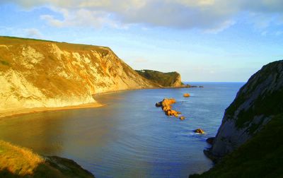
Man O' War Bay
Man O' War Bay as seen from the cliffs of Durdle Door in Dorset, England. The Purbeck Monoclines seen on the left adots a golden hue in the evening sun to give this beautiful bay a further magical touch.
Picture © 2005 onwards by Dr Himanshu Tyagi. All the photographs in this blog are copyright protected and can not be reproduced or stored in any medium without the written permission from Dr Himanshu Tyagi.
Jordan Hill Roman Temple
Jordan Hill Roman Temple in Overcombe, Weymouth, South of England. Despite being regarded as a temple, there is a faint possibility that it was an early lighthouse for guiding ships into the Bowleaze Cove. It was certainly not a military installation as there were no defences, and it was too large for purely domestic use.
Picture © 2005 onwards by Dr Himanshu Tyagi. All the photographs in this blog are copyright protected and can not be reproduced or stored in any medium without the written permission from Dr Himanshu Tyagi.
Overcombe
This stunning view of Weymouth Bay is from Jordan Hill in Overcombe. Overcombe is a town in south Dorset, England, situated on top of cliffs two miles east of Weymouth. It is also the location of Jordan Hill Roman Temple.
Picture © 2005 onwards by Dr Sanjukta Acharya. All the photographs in this blog are copyright protected and can not be reproduced or stored in any medium without the written permission from Dr Himanshu Tyagi.
Dungy Head
Dungy Head is the best place to see the Portland strata. The lowest part, the Portland Sand can be seen at the base of the cliffs, round the corner to the east of Dungy Head. It is an interesting place and some ammonites can be found. The Portland Stone (or Winspit Member) is mostly an oolite or ooid grainstone at Dungy Head becoming an ooid packstone east of Lulworth Cove (Townson, 1975). The Portland Cherty Series is well seen at Dungy Head and both the upper part or Dancing Ledge Member of Townson (1975) and the lower part, the Dungy Head Member, contains much sponge spicule (Rhaxella ) wackestone, the silica from which has given rise to the chert. Most of the chert is early, as is usually the case; some is late and related to faulting. The conspicuous thin marker bed know as Puffin Ledge (Puffins used to nest on in the Isle of Purbeck) is easily recognised as a thin bed in the middle and is usually characterised by Thallassinoides burrows. Giant ammonites, Titanites occur at about this level. Fine grained dolomites known as the Black Sandstones and part of the Gad Cliff Member. These contain the ammonite Glaucolithites.
References: 1. Dr Ian West, School of Ocean and Earth Sciences, Southampton University, Southampton Oceanography Centre, http://www.soton.ac.uk/~imw/dungy.htm
Picture © 2005 onwards by Dr Sanjukta Acharya. All the photographs in this blog are copyright protected and can not be reproduced or stored in any medium without the written permission from Dr Himanshu Tyagi.
Portland Limestone
Limestone is partially soluble, especially in acid, and therefore forms many erosion landforms. These include limestone pavements, pot holes, caves and gorges. Such erosion landscapes are known as karsts. Limestone is less resistant than most igneous rocks, but more resistant than most other sedimentary rocks. Limestone is therefore usually associated with hills and downland and occurs in regions with other sedimentary rocks, typically clays. Bands of limestone emerge from the Earth's surface in often spectacular rocky outcrops and islands. Examples include the Verdon Gorge in France; Malham Cove in North Yorkshire, England; and the Ha Long Bay National Park in Vietnam. This photograph was taken at West Lulworth Coast where Portland stone is still visible.
Picture © 2004 onwards by Dr Sanjukta Acharya. All the photographs in this blog are copyright protected and can not be reproduced or stored in any medium without the written permission from Dr Himanshu Tyagi.
Durdle Door
Durdle Door (sometimes spelt Durdle Dor) is a natural limestone arch on the Jurassic Coast near West Lulworth in Dorset, England. The arch has formed on a concordant coastline where bands of rock run parallel to the shoreline. Here the rock strata run near vertical, and the bands of rock are quite narrow. Originally a band of resistant Portland Limestone ran along the shore, the same band which can be seen two miles down the coast forming the narrow entrance to Lulworth Cove. Behind this is a 400 ft (120 metre) band of various weaker rocks which are easily eroded, and behind this is a stronger and much thicker band of chalk, which forms the Purbeck Hills. The limestone and chalk are much closer together here than at Swanage, ten miles to the east, where the distance between them is over two miles. This is because plate tectonics has twisted and folded the rocks forcing the strata vertical here, and this pressure has also compressed the clays. At Durdle bay all except a short stretch of the limestone has been completely eroded away by the sea and the remainder forms a small headland where it has protected the clay behind. At the western end this band of limestone has been eroded through, creating the natural arch. The 400 foot isthmus which joins the limestone to the chalk is made of a 50 metre band of Portland Limestone, which is less resistant than the Portland beds, a narrow and compressed band of Eocine clays, Wealdon Clay, sands and chert beds and then narrow bands of Greensand and sandstone. In Man-of-War bay, the small bay immediately east of Durdle Door the Portland stone has not been entirely eroded away, and at low tide the band of Portland stone is partially revealed. Durdle Door is a popular tourist "honeypot," as it is a short walk from the equally popular Lulworth Cove, and lies on the South West Coast Path. Within walking distance of the car park at Lulworth are these two unique landforms, a fossilised forrest and examples of common rock types from the Jurassic, Triassic and Cretaceous. The area is part of the 95 mile World Heritage Site because of its geology, and these factors make the site one of the most visited natural tourist attractions in the country, with the National Trust estimating the number of hiking journeys across Hambury Tout between Lulworth and Durdle Door as being over a million annually.
Picture © 2004 onwards by Dr Sanjukta Acharya. All the photographs in this blog are copyright protected and can not be reproduced or stored in any medium without the written permission from Dr Himanshu Tyagi.
Man O' War Rocks
The beautiful Man O' War Rocks in Man O' War Bay in Dorset, England. In this small bay immediately east of Durdle Door the Portland stone has not been entirely eroded away, and at low tide the band of Portland stone is partially revealed. This photograph was taken from the top of Purbeck Monocline.
© 2004 onwards by Dr Himanshu Tyagi. All the photographs in this blog are copyright protected and can not be reproduced or stored in any medium without the written permission from Dr Himanshu Tyagi.
Sunday, October 02, 2005
West Lulworth
West Lulworth is a village in the Purbeck district of Dorset, England, sitated on the English Channel coast beside Lulworth Cove. The village has a population of 766 (2001), 9.3% of dwellings are second homes. The village is a gateway town to the Jurassic Coast world heritage site and is a popular tourist "honeypot". This photograph was taken from the Purbeck Hills south west of West Lulworth and shows the picteresque landscape of the surroundings of this small village.
© 2004 onwards by Dr Himanshu Tyagi. All the photographs in this blog are copyright protected and can not be reproduced or stored in any medium without the written permission from Dr Himanshu Tyagi.
Friday, September 30, 2005
Bridge
The arch was first used by the Roman Empire for bridges and aqueducts, some of which still stand today. The Romans also had cement, which reduced the variation of strength found in natural stone. Brick and mortar bridges were built after the Roman era, as the technology for cement was lost then later rediscovered. This photograph was taken on the Roman Walk, Dorchester, Dorset.
© 2004 onwards by Dr Himanshu Tyagi. All the photographs in this blog are copyright protected and can not be reproduced or stored in any medium without the written permission from Dr Himanshu Tyagi.
Pond
A pond is a body of water smaller than a lake. However the difference between a pond and a lake is subjective. Pond usually describes small bodies of water, generally smaller than one would require a boat to cross. Another definition is that a pond is a body of water where even its deepest areas are reached by sunlight. In some dialects of English, pond normally refers to small artificially created bodies of water. There are various regional names for naturally occurring ponds, e.g. in Scotland, one of the terms is lochan. The word "pond" is sometimes also used to refer to the Atlantic Ocean in the expression "across the pond" (a deliberate idiomatic understatement).
© 2004 onwards by Dr Himanshu Tyagi. All the photographs in this blog are copyright protected and can not be reproduced or stored in any medium without the written permission from Dr Himanshu Tyagi.
Leaf Peeping
Leaf peeping is an activity that one might partake in during autumn in areas where the foliage changes colors. It is the act of admiring autumn foliage for its beauty. A person who leaf peeps is called a leaf peeper. Leaf peepers are often tourists and are known for driving slowly on public roads. This activity was lampooned in the animated television show Family Guy in the episode Lethal Weapons.
© 2004 onwards by Dr Himanshu Tyagi. All the photographs in this blog are copyright protected and can not be reproduced or stored in any medium without the written permission from Dr Himanshu Tyagi.
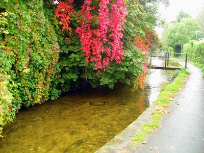
Mill Stream
The Mill Stream along side the Roman Town Walk in Dorchester, Dorset, England is a branch of River Frome which rises some 10 miles to the north west and flows into Poole harbour. Thomas Hardy, who lived in Dorchester for most of his life, referred to the Frome valley as 'The Vale of Great Dairies' and today it is still farmed and home to a variety of flora and fauna.
© 2004 onwards by Dr Himanshu Tyagi. All the photographs in this blog are copyright protected and can not be reproduced or stored in any medium without the written permission from Dr Himanshu Tyagi.
Drake Mallard
The breeding male mallard duck is unmistakable, with a green head, black rear end and a blue speculum edged with white, obvious in flight or at rest. Males also possess a yellow bill with a black tip, whereas females have a dark brown bill. The females are light brown, with plumage much like most female dabbling ducks. They can be distinguished from other ducks, by the distinctive speculum. In non-breeding (eclipse) plumage, the drake looks more like the female. It is a bird of most wetlands, including parks, small ponds and rivers, and usually feeds by dabbling for plant food or grazing. It nests usually on a river bank, but not always particularly near water. This is a noisy species. The male has a nasal call, whereas the female has the very familiar "quack" always associated with ducks.
© 2004 onwards by Dr Himanshu Tyagi. All the photographs in this blog are copyright protected and can not be reproduced or stored in any medium without the written permission from Dr Himanshu Tyagi.
Wednesday, September 28, 2005
Silhouette
A silhouette is a view of an object or scene consisting of the outline and a featureless interior. The term comes from 'tienne de Silhouette, Louis XV's miserly finance minister. A silhouette is a form of artwork. It is most commonly a human portrait in profile, in black. Most silhouettes are formed by tracing the shadow of the subject and cutting along the resultant outline.
© 2004 onwards by Dr Himanshu Tyagi. All the photographs in this blog are copyright protected and can not be reproduced or stored in any medium without the written permission from Dr Himanshu Tyagi.
Autumn
I was driving on a hilly road when I came across this beautiful view. Instinctively I pushed the brake pedal along with fellow drivers. We all scuttled to take pictures of this lovely sight. Autumn's association with the transition from warm to cold weather in the northern hemisphere, and its related status as the season of the primary harvest, has dominated its themes and popular images. In Western cultures, personifications of Autumn are usually pretty, well-fed females decked out with fruits, vegetables and grains that ripen at this time. Most ancient cultures featured autumnal celebrations of the harvest, often the most important on their calendars. Still extant echoes of these celebrations are found in the late-Autumn Thanksgiving holiday of the United States, the Jewish Sukkot holiday with its roots as a full moon harvest festival of "tabernacles" (huts wherein the harvest was processed and which later gained religious significance), the many North American Indian festivals tied to harvest of autumnally ripe foods gathered in the wild, the Chinese Mid-Autumn or Moon festival, and many others. The predominant mood of these autumnal celebrations is a gladness for the fruits of the earth mixed with a certain melancholy linked to the imminence of harsh weather. Remembrance of ancestors is also a common theme.
© 2004 onwards by Dr Himanshu Tyagi. All the photographs in this blog are copyright protected and can not be reproduced or stored in any medium without the written permission from Dr Himanshu Tyagi.
Dry Season
The dry season is a term commonly used when describing the weather in the tropics. The weather in the tropics is dominated by the tropical rain belt, which oscillates from the northern to the southern tropics over the course of the year. The tropical rain belt lies in the southern hemisphere roughly from October to March, and during this time the northern tropics experience a dry season in which precipitation is very rare, and days are typically hot and sunny throughout. From April to September, the rain belt lies in the northern hemisphere, and the southern tropics experience their dry season.
© 2004 onwards by Dr Himanshu Tyagi. All the photographs in this blog are copyright protected and can not be reproduced or stored in any medium without the written permission from Dr Himanshu Tyagi.
Hamlet
A hamlet is a small settlement, too small or unimportant to be considered a village. The name comes from the diminutive of a Germanic word for an enclosed piece of land or pasture. In the UK, a hamlet is defined ecclesiastically. It is a village that may or may not have its own church, but which does not form a parish in its own right.
© 2004 onwards by Dr Himanshu Tyagi. All the photographs in this blog are copyright protected and can not be reproduced or stored in any medium without the written permission from Dr Himanshu Tyagi.
Rainbow Arc
The rainbow's appearance is caused by dispersion of sunlight as it is refracted by (approximately spherical) raindrops. The light is first refracted as it enters the surface of the raindrop, reflects off the back of the drop, and is again refracted as it leaves the drop. The overall effect is that the incoming light is reflected back over a wide range of angles regardless of the size of the drop. Since the water of the raindrops is dispersive, the amount that the sunlight is bent depends upon the wavelength (colour) of the light's constituent parts. Blue light is refracted at a greater angle than red light, but because the area of the back of the droplet has a focal point inside the droplet, the spectra crosses itself, and thus the red light appears higher in the sky, and forms the outer colour of the rainbow. Contrary to popular belief, the light at the back of the raindrop does not undergo total internal reflection; however, light that emerges from the back of the raindrop does not create a rainbow between the observer and the sun. This is because the emitted spectra there do not have a maximum of intensity, as the other visible rainbows do. Thus the colours blend together and do not form any rainbow.
© 2004 onwards by Dr Himanshu Tyagi. All the photographs in this blog are copyright protected and can not be reproduced or stored in any medium without the written permission from Dr Himanshu Tyagi.
Silver Birch
Silver Birch (Betula pendula) is a widespread European birch, though in southern Europe it is only found at higher altitudes. Its range extends into southwest Asia in the mountains of northern Turkey and the Caucasus. The closely related Siberian Silver Birch (B. platyphylla) in northern Asia and Sichuan Birch (B. szechuanica) of central Asia are also treated as varieties of Silver Birch by some botanists, as B. pendula var. platyphylla and B. pendula var. szechuanica respectively. It is a medium size deciduous tree, typically reaching 15-25 m tall, exceptionally up to 30 m, with a slender crown of arched branches with drooping branchlets. The bark is white, often with black diamond-shaped marks or larger patches at the base. The shoots are rough with small warts, and hairless, and the leaves 3-6 cm long, triangular with a broad base and pointed tip, and coarsely serrated margins. The flowers are wind-pollinated catkins, produced before the leaves in early spring, the small (1-2 mm) winged seeds ripening in late summer on 3-5 cm long catkins.
© 2004 onwards by Dr Himanshu Tyagi. All the photographs in this blog are copyright protected and can not be reproduced or stored in any medium without the written permission from Dr Himanshu Tyagi.
Global Dimming
Clouds intercept both heat from the sun and heat radiated from the Earth. Their effects are complex and vary in time and location and height. Usually, during the day the interception of sunlight predominates, giving a cooling effect; however, at night the re-radiation of heat to the Earth slows the earth's heat loss. Global dimming is a term describing the gradual reduction in the amount of sunlight observed reaching the Earth's surface since the 1950s. The effect varies by location but globally is of the order of a 5% reduction over the three decades 1960-1990; the trend has reversed during the past decade. Global dimming creates a cooling effect that may have led scientists to underestimate the effect of greenhouse gases on global warming.
© 2004 onwards by Dr Himanshu Tyagi. All the photographs in this blog are copyright protected and can not be reproduced or stored in any medium without the written permission from Dr Himanshu Tyagi.
Landscape
The word landscape as most westerners use it is completely entrenched in western notions of land, nature and art. It is generally only conceived of in terms of an emerging post-Renaissance dichotomy of nature vs. culture or pristine vs. mundane and contaminated. Alternatively, the genesis of the western concept of landscape is tied to the discovery of linear perspective and map-making. It is not true, however, that understandings of landscape, even within western culture, are necessarily formed around concepts of untouched nature or which locate the observer (as in the trope of the painted landscape) outside of the picture, the landscape itself. For many people, the dense mesh of city buildings is their landscape and their art may reflect this. For others, human intervention in the natural world may be seen as the ideal environment and "visual pleasure" may be brought about by views of cleared tracts of land juxtaposed with threatening wilderness. The actual word "Landscape" is derived from the Dutch, "Landschap" or German "'Landschaft' meaning a sheaf, a patch of cultivated ground, something small-scale that corresponded to a peasant's perception, a mere fragment of a feudal estate, an inset in a Breugel landscape. This usage had gone out of vogue by the eleventh century, replaced by words that corresponded to the larger political spaces of those with power - territoire, pays, domain. And then in the seventeenth and eighteenth centuries it re-emerged, tightly tied to a particular 'way of seeing', a particular experience, whether in pictures, extolling nature or landscaping an estate" (B. Bender in Landscape: Politics and Perspectives 1995:2). Through tracing the history of the term we come to see that even within the realm of art, it is tied to politics and power of conceptual organization, ownership and perspective. That landscape painting as form of representation was established in 15th century Italy and Flanders was due to new politics of vision. In fact, landscape, be it used to describe a genre of painting or the world we locate ourselves within, is never empty, never just a 'vista'. And, equally as significantly, never only experienced visually. When the term landscape refers to a static painting, weather and sky conditions are also important elements.
© 2004 onwards by Dr Himanshu Tyagi. All the photographs in this blog are copyright protected and can not be reproduced or stored in any medium without the written permission from Dr Himanshu Tyagi.
Catbells
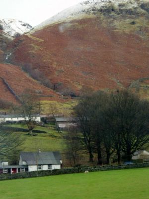
Catbells is a fell in the English Lake District in the county of Cumbria. It has a modest height of 451 m (1481 ft) but despite this it is one of the most popular fells in the area. It is situated on the western shore of Derwentwater within five kilometres of the busy tourist town of Keswick. It's distinctive shape catches the attention of many visitors to the Lakes who feel compelled to climb to the summit after seeing it from the viewpoint of Friars Crag on the opposite side of Derwentwater. Renowned Lake District writer and walker Alfred Wainwright acknowledges the popularity of Catbells among fellwalkers of all ability by saying: "It is one of the great favourites, a family fell where grandmothers and infants can climb the heights together, a place beloved. It's popularity is well deserved, it's shapely topknott attracts the eye offering a steep but obviously simple scramble."
© 2004 onwards by Dr Himanshu Tyagi. All the photographs in this blog are copyright protected and can not be reproduced or stored in any medium without the written permission from Dr Himanshu Tyagi.
Plumage
Many of the brilliant colors of the peacock plumage are due to an optical interference phenomenon (Bragg reflection) based on (nearly) periodic nanostructures found in the barbules (fiber-like components) of the feathers. Different colors correspond to different length scales of the periodic structures. For brown feathers, a mixture of red and blue is required one color is created by the periodic structure, while the other is a created by a Fabry-Perot interference peak from reflections off the outermost and innermost boundaries of the periodic structure. Such interference-based structural color is especially important in producing the peacock's iridescent hues (which shimmer and change with viewing angle), since interference effects depend upon the angle of light, unlike chemical pigments. In captivity, the peafowl has produced many plumage colour variations. Those are mutations that have been secured by selective breeding. They included: white bodied, barred winged, white eyed, pied, cameo, charcoal, bronze, opal, peach, midnight, purple, and any combination of these variations.
© 2004 onwards by Dr Himanshu Tyagi. All the photographs in this blog are copyright protected and can not be reproduced or stored in any medium without the written permission from Dr Himanshu Tyagi.
Royal Weekend Party
The Royal Weekend Party brings to life the secrets of a Victorian household and all its important guests. You can encounter a young Winston Churchill and listen to Clara Butt, renowned singer of the time and Paolo Tosti, music master to the Royal Family. Most of the furnishings and fittings are those that were actually here in 1898, and photographs taken at the time mean that it has been possible to put every chair, table, bed and book in exactly the place it occupied exactly 100 years ago. Daisy's exquisite evening gown and the lavish decoration of her bedroom were recreated from photographs of Daisy's ancestral home, Easton Lodge. It was clear that no expense was spared in her luxurious lifestyle.
© 2004 onwards by Dr Himanshu Tyagi. All the photographs in this blog are copyright protected and can not be reproduced or stored in any medium without the written permission from Dr Himanshu Tyagi.
Large Tree
The largest trees in total volume are those which are both tall and of large diameter, and in particular, which hold a large diameter high up the trunk. Measurement is very complex, particularly if branch volume is to be included as well as the trunk volume, so measurements have only been made for a small number of trees, and generally only for the trunk. No attempt has ever been made to include root volume.
© 2004 onwards by Dr Himanshu Tyagi. All the photographs in this blog are copyright protected and can not be reproduced or stored in any medium without the written permission from Dr Himanshu Tyagi.
River Avon
The source of the River Avon is near the village of Naseby in Northamptonshire. For the first few miles of its length between Welford and the Dow Bridge on Watling Street, it forms the border between Northamptonshire and Leicestershire. On this section, it has been dammed to create Stanford Reservoir. It then flows in a generally west-southwesterly direction, not far north of the Cotswold edge and through the Vale of Evesham, passing through the towns and villages of Welford, Rugby, Wolston, Leamington Spa, Warwick, Stratford-upon-Avon, Welford-on-Avon, Bidford-on-Avon, Evesham and Pershore, before it joins the River Severn at Tewkesbury. Also seen in the picture a small boat-house.
© 2004 onwards by Dr Himanshu Tyagi. All the photographs in this blog are copyright protected and can not be reproduced or stored in any medium without the written permission from Dr Himanshu Tyagi.
Castle Grounds
Legend has it that the first fortifications of significance at Warwick castle were erected by Ethelfleda, daughter of king Alfred the Great, in the year 914. These almost certainly replaced even older wooden fortifications, which had proven ineffective against marauding Danes who had sacked the town in the reign of her father. They were part of a network of fortifications built to protect the Kingdom of Mercia.
© 2004 onwards by Dr Himanshu Tyagi. All the photographs in this blog are copyright protected and can not be reproduced or stored in any medium without the written permission from Dr Himanshu Tyagi.
Curtain Walls
The walkways in Warwick Castle that run along the curtain walls meant that crossbowmen and archers could move swiftly to quell danger at any point on the perimeter. Once in position they could pick off the enemy from the battlements. These consist of solid sections of wall, called merlons, and gaps, known as embrasures. The tops of the towers are encircled by parapets that added a further layer to the castle's defences. Cut into the floor of the parapet at regular intervals are openings, or machicolations, through which the garrison could drop stones or pour boiling pitch and quicklime onto the unfortunate attackers below.
© 2004 onwards by Dr Himanshu Tyagi. All the photographs in this blog are copyright protected and can not be reproduced or stored in any medium without the written permission from Dr Himanshu Tyagi.
Clarence Tower
Set in the centre of the north wall of Warwick Castle, these two stunted towers are all that is left of the mighty Tower House which Richard of Gloucester (future King Richard III) started to build in 1478. It was to have been the same height as Guy's Tower, but twice as wide, with a turret at each of its four corners. However, this gigantic Royal Keep was intended not just to repel an attack from beyond the walls. It was also designed to protect against a mutinous attack from within the castle itself. At ground level wells were dug and baking ovens installed, providing the domestic means necessary for those safe inside to endure an attack. In the walls, arrow loops and holes drilled to take cannon are features of the structure's defensive measures. In 1485 Richard was killed at Bosworth and the building stopped. The Clarence Tower is named after Richard's elder brother, the Duke of Clarence. It is thought that the other tower housed bears that were used for baiting.
© 2004 onwards by Dr Himanshu Tyagi. All the photographs in this blog are copyright protected and can not be reproduced or stored in any medium without the written permission from Dr Himanshu Tyagi.
Dumper
When waves "break", they have different characteristics depending on factors including the structure of the ocean floor. There are three main types that are identified by surfers or surf lifesavers: plunging waves (also known as "dumpers"), spilling waves and surging waves. Their varying characteristics make them more or less suitable for surfing and present different dangers.
© 2004 onwards by Dr Himanshu Tyagi. All the photographs in this blog are copyright protected and can not be reproduced or stored in any medium without the written permission from Dr Himanshu Tyagi.
Fellwalking
Hillwalking or fellwalking is the recreational practice of hiking in mountainous terrain. While the primary activity is walking, an outing may also involve stretches of rougher terrain that require different skills. Many hill-walkers become proficient in scrambling and some even carry basic climbing equipment. Another skill often involved is that of navigation, especially in conditions of poor visibility. There is not always a clear-cut distinction between hillwalking and mountaineering, but the latter term is typically used to describe more adventurous activities, often at higher altitudes.
© 2004 onwards by Dr Himanshu Tyagi. All the photographs in this blog are copyright protected and can not be reproduced or stored in any medium without the written permission from Dr Himanshu Tyagi.
Bournemouth Pier
The first pier in Bournemouth consisted of a short wooden jetty that was completed in 1856. This was replaced by a much longer wooden pier, designed by George Rennie, which opened on September 17, 1861. Due to attack by Teredo worm the wooden piles were removed in favour of cast iron replacements in 1866, but even with this additional benefit just over a year later the pier was made unusable when the T-shaped landing stage was swept away in a gale. After repairs the pier continued in use for a further ten years until November 1876 when another severe storm caused further collapse rendering the pier too short for steamboat traffic. The Rennie pier was subsequently demolished, and replaced in 1877 by a temporary structure. During the next three years a new pier, designed by Eugenius Birch, was completed. At a cost of 21,600 the new Bournemouth Pier was opened by the Lord Mayor of London on August 11, 1880. Consisting of an open promenade, it stretched to a length of 838ft (255.4m) and spanned some 35ft (10.6m) across the neck of the pier, extending to 110ft (33.3m) at the head. With the addition of a bandstand In 1885, military band concerts took place three times a day in summer and twice daily throughout the winter. Covered shelters were also provided at this time. Two extensions, in 1894 and 1909 respectively, took the pier's overall length to more than 1000ft (304.8m). In common with virtually all other piers in the south and east of the country, Bournemouth Pier was substantially demolished by an army demolition team in the spring of 1940 as a precaution against German invasion. The pier was repaired and re-opened in August 1946. Refurbishment of the pier head was carried out in 1950, and ten years later a rebuild of the substructure was completed in concrete to take the weight of a new pier theatre. A structural survey of 1976 found major areas of corrosion, and in 1979 a -L-1.7m restoration program was initiated. Having demolished the old shoreward end buildings, replacing them with a new two storey octagonal leisure complex, and reconstructed the pier neck in concrete giving it the bridge-like appearance that it retains today, the work was completed in two years.
© 2004 onwards by Dr Himanshu Tyagi. All the photographs in this blog are copyright protected and can not be reproduced or stored in any medium without the written permission from Dr Himanshu Tyagi.
Old Harry Rocks
Old Harry Rocks at Handfast Point are a small but characteristic set of coastal landforms off Ballard Down at the eastern end of the Jurassic Coast world heritage site near Swanage in Dorset, England. The rocks are situated in the English Channel where the Purbeck Hills fall into the sea. The rocks include a collection of islands, a natural arch, stacks and stumps on a wave cut platform formed by erosion of the chalk cliffs. Sometimes the name Old Harry is used to refer to the sea arch part and Old Harry's Wife to the stump. The rocks are part of a once continuous band of chalk which ran through south Dorset, Ballard Down and the Isle of Wight, part of the southern England Chalk Formation. The rocks and the downs are a short walk from Studland and Swanage, and are a few miles south of the gateway towns of Poole and Bournemouth. Legend says that the Devil had a sleep on the rocks, which lead to the old euphemism of the Devil being called "Old Harry".
© 2004 onwards by Dr Himanshu Tyagi. All the photographs in this blog are copyright protected and can not be reproduced or stored in any medium without the written permission from Dr Himanshu Tyagi.
Coast
The section of the coast both to the east and to the west of Bournemouth was very important during World War 2. For example Poole Harbour was the departure point for many ships participating in the D-Day landings, and Studland Bay (just west of Bournemouth) was the scene of practice live fire beach landings in preparation for the Normandy Landings. Bournemouth itself was not a main target of bombing during WW2 but was on the route for other raids (e.g. on Coventry) and German bombers were known to unload their spare bombs on the town; 219 local people were killed by bombing during the war.
© 2004 onwards by Dr Himanshu Tyagi. All the photographs in this blog are copyright protected and can not be reproduced or stored in any medium without the written permission from Dr Himanshu Tyagi.
Bournemouth Sea
Bournemoth seen from Studland. The Bournemouth area has long been a place wherein many unusual species of animals and plants can be found. Brownsea island, in nearby Poole Harbour, is one of the few places in the south where the red squirrel still remains, and the ant Formica pratensis had its last stronghold in the area, although it is now thought to be extinct on the mainland. Although described by Farren White as "the common wood ant of Bournemouth" in the mid-19th century, the noted entomologist Horace Donisthorpe found only one colony of true pratensis out of hundreds of F. rufa nests there in 1906. In recent times the last known two colonies disappeared in the 1980s, making this ant the only ant species thought to have become extinct in Great Britain. It does, however, still survive on cliff-top locations in the Channel Islands. The rare narrow-headed ant also used to exist in Bournemouth, although it has died out in the area.
© 2004 onwards by Dr Himanshu Tyagi. All the photographs in this blog are copyright protected and can not be reproduced or stored in any medium without the written permission from Dr Himanshu Tyagi.
Poole Harbour
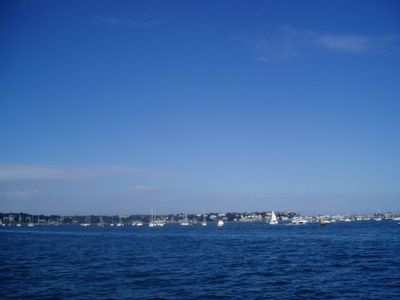
Poole Harbour (said to be the second largest natural harbour in the world after Sydney) has been a working port for many hundreds of years, though the port has declined somewhat as the shallow water cannot take the largest ships. The harbour is noted for its ecology, supporting saltmarsh, mudlats and an internationally important population of wintering waterfowl as well as the Brownsea Island nature reserve, where the Scouting movement began. Today the port is amongst other things the home of Sunseeker, manufacturers of luxury yachts, and the departure point for ferries (Brittany Ferries, Condor and Truckline) to France. The quayside and harbour was the place from which some ships departed for the D-Day landings of World War II.
© 2004 onwards by Dr Himanshu Tyagi. All the photographs in this blog are copyright protected and can not be reproduced or stored in any medium without the written permission from Dr Himanshu Tyagi.
Tuesday, September 27, 2005
Grasmere
Grasmere is a village in central Cumbria in the north of England, and is also the name of the adjacent lake. Grasmere's position in the centre of the English Lake District has made it popular as a tourist destination. The town is overlooked by the small rocky hill of Helm Crag, popularly known as 'The Lion and the Lamb' due to the shape of rock formations on its summit. William Wordsworth lived in Dove Cottage, in the hamlet of Town End, near Grasmere. This photograph was taken on the way to Grasmere from Keswick.
© 2004 onwards by Dr Himanshu Tyagi. All the photographs in this blog are copyright protected and can not be reproduced or stored in any medium without the written permission from Dr Himanshu Tyagi.
Derwent Water
Derwent Water (or Derwentwater) is one of the principal bodies of water in the Lake District National Park in the north of England. The lake occupies part of Borrowdale and lays immediately south of the town of Keswick. It is both fed and drained by the River Derwent. It measures approximately 4 km (3 miles) long by 1.5 km (1 mile) wide and is some 22 metres (72 feet) deep. There are several islands within the lake, of which at least one is inhabited. Derwentwater is a place of considerable scenic value. It is surrounded by hills (known locally as fells), and many of the slopes facing Derwentwater are extensively wooded. A regular passenger launch operates on the lake, taking passengers between various landing stages. There are two lakeside marinas, one at Keswick and one at nearby Portinscale, from which boats may be hired. Recreational walking is a major tourist activity in the area and an extensive network of footpaths exists within the hills and woods surrounding the lake. It gave its name to the Earldom of Derwentwater.
© 2004 onwards by Dr Himanshu Tyagi. All the photographs in this blog are copyright protected and can not be reproduced or stored in any medium without the written permission from Dr Himanshu Tyagi.
Grove
A small group of trees growing together is called a grove or copse, and a landscape covered by a dense growth of trees is called a forest. Several biotopes are defined largely by the trees that inhabit them; examples are rainforest and taiga. A landscape of trees scattered or spaced across grassland (usually grazed or burned over periodically) is called a savanna.
© 2004 onwards by Dr Himanshu Tyagi. All the photographs in this blog are copyright protected and can not be reproduced or stored in any medium without the written permission from Dr Himanshu Tyagi.
Beach
The shape of a beach depends on whether the waves are constructive or destructive, and whether the material is sand or shingle. Constructive waves move material up the beach while destructive waves move the material down the beach. On sandy beaches, the backwash of the waves removes material forming a gently sloping beach. On shingle beaches the swash is dissipated because the large particle size allows percolation, so the backwash is not very powerful, and the beach remains steep. Cusps and horns form where incoming waves divide, depositing sand as horns and scouring out sand to form cusps. This forms the uneven edge of a sandy beach. This photograph was taken on the south coast of England.
© 2004 onwards by Dr Himanshu Tyagi. All the photographs in this blog are copyright protected and can not be reproduced or stored in any medium without the written permission from Dr Himanshu Tyagi..
Seagull
Gulls are seabirds in the family Laridae. They are most closely related to the terns (family Sternidae), and more distantly to the waders, auks and skimmers. Most gulls belong to the large genus Larus. They are in general medium to large birds, typically grey or white, often with black markings on the head or wings. They have stout, longish bills and webbed feet. Most gulls, particularly Larus species, are ground nesting omnivores, which will take live food or scavenge opportunistically. The live food often includes crabs and small fish. In this picture you can see a single seagull flying peacefully over the coast.
© 2004 onwards by Dr Himanshu Tyagi. All the photographs in this blog are copyright protected and can not be reproduced or stored in any medium without the written permission from Dr Himanshu Tyagi.
Pier
This photograph was taken close to the Bournemouth pier. The first pier in Bournemouth consisted of a short wooden jetty that was completed in 1856. This was replaced by a much longer wooden pier, designed by George Rennie, which opened on September 17, 1861. Due to attack by Teredo worm the wooden piles were removed in favour of cast iron replacements in 1866, but even with this additional benefit just over a year later the pier was made unusable when the T-shaped landing stage was swept away in a gale. After repairs the pier continued in use for a further ten years until November 1876 when another severe storm caused further collapse rendering the pier too short for steamboat traffic. The Rennie pier was subsequently demolished, and replaced in 1877 by a temporary structure. During the next three years a new pier, designed by Eugenius Birch, was completed.
© 2004 onwards by Dr Himanshu Tyagi. All the photographs in this blog are copyright protected and can not be reproduced or stored in any medium without the written permission from Dr Himanshu Tyagi.
Trebuchet
Siege machines were developed in the 13th century to attack the solid Castle walls. As the defences of Castles improved so did the weapons of attack and siege machines were developed to attack the solid Castle walls. The trebuchet was the largest and most formidable of the siege machines and was, in essence, a huge catapult. A trebuchet is moved by a counterweight. The axle of the arm is near the top of a high strutted vertical frame. The shorter arm of the balance carries the counterweight and the longer arm the sling that carries the shot. The sling is usually braided from rope, and has a captive end attached to the arm, and a free end whose loop slips from a hook. A trigger, usually a toggle in a chain, holds the arm down after the trebuchet is cocked. Cocking is often performed with windlasses. The cocking sometimes was assisted by removing some or all of the stones or sand that acted as the counterweight. Because of the long winding time, a trebuchet's rate of fire was extremely slow, often not more than a couple of shots an hour. Yet some of the smaller types of trebuchets could fire a couple times a minute. In operation the long, nonweighted end is pulled toward the ground, and held by a trigger. When the trigger is released, the arm pulls the sling out of a channel in the base of the frame. When the ball moves close to the top of its arc, the free end of the sling slips from the hook, and the missile flies free. The trebuchet's arm and frame then oscillate for several cycles.
© 2004 onwards by Dr Himanshu Tyagi. All the photographs in this blog are copyright protected and can not be reproduced or stored in any medium without the written permission from Dr Hiamnshu Tyagi.
Bridge
An old medieval bridge in warwick castle. Legend has it that the first fortifications of significance at Warwick castle were erected by Ethelfleda, daughter of king Alfred the Great, in the year 914. These almost certainly replaced even older wooden fortifications, which had proven ineffective against marauding Danes who had sacked the town in the reign of her father. They were part of a network of fortifications built to protect the Kingdom of Mercia. The remains of these ancient fortifications can still be seen on top of a large mound at the southern end of the castle's courtyard, which is known as Ethelfleda's mound, although most of these remains date from the Norman period.
© 2004 onwards by Dr Himanshu Tyagi. All the photographs in this blog are copyright protected and can not be reproduced or stored in any medium without the written permission from Dr Hiamnshu Tyagi.
Subscribe to:
Posts (Atom)